Overview
Thunderstruck's 100% owned, high-grade Nakoro zinc/copper volcanic massive sulphide (VMS) prospect boasts a historical resource of 4.3% CuEq and sits within an 8 km untested prospective geologic horizon which is open at depth and along strike. Nakoro is hosted within the same geologic unit as Thunderstruck’s highly prospective Korokayiu VMS prospect.
Location
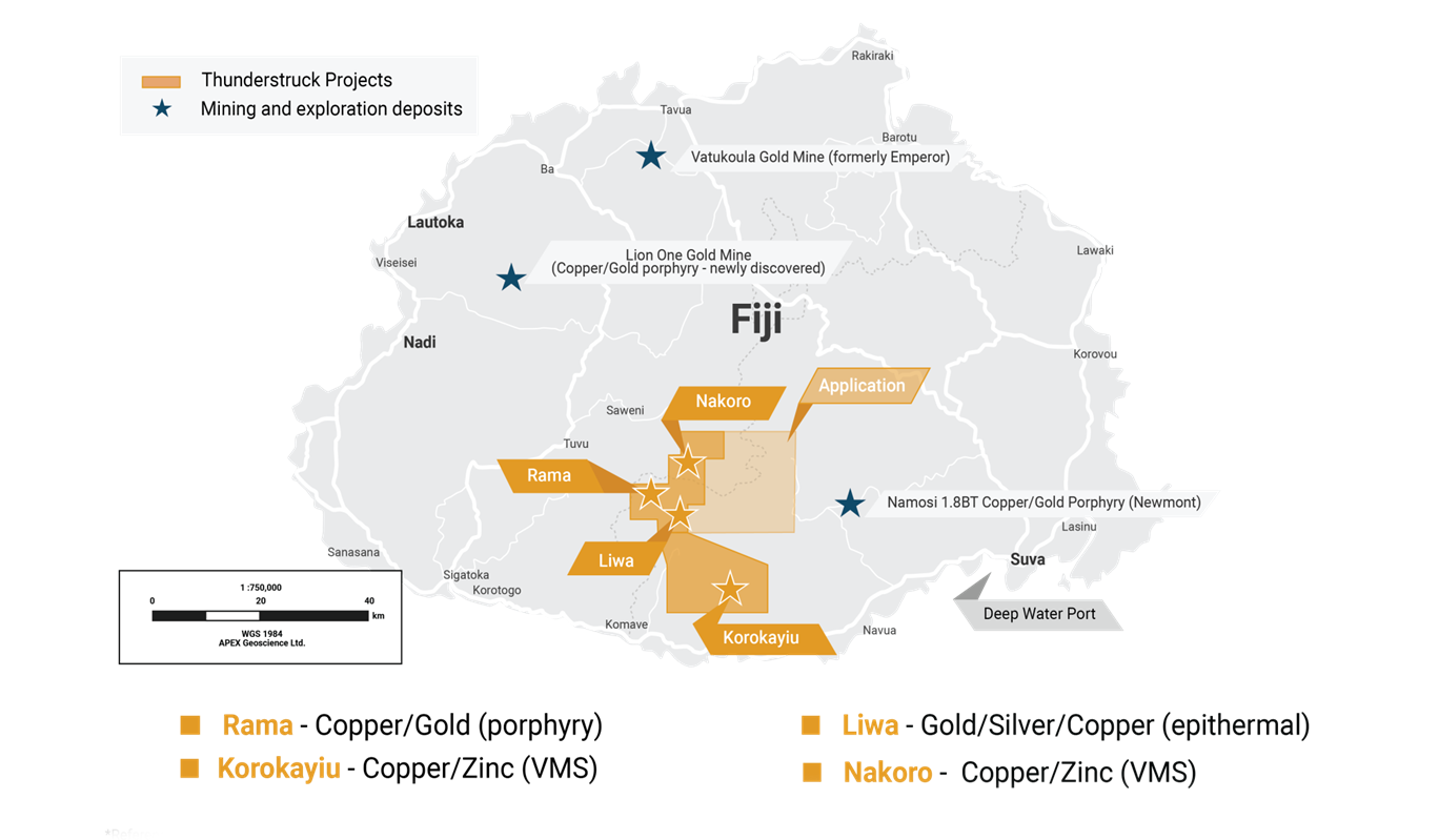
The Nakoro VMS prospect is located on Fiji’s largest island, Viti Levu. Nakoro is 25km north and contiguous to Thunderstruck’s Korokayiu VMS asset, allowing for the possibility of a hub and spoke mining district with central processing plant. The prospect sits within the 148km2 land package of Special Prospecting License No. 1425 and is approximately 50 km northwest of the capital and deep-water port of Suva.

History
Nakoro’s zinc/copper potential was initially discovered through country-wide stream sediment sampling programs undertaken by Barringer in the 1960’s. Barringer entered a joint venture with Australian Anglo American who carried out two drill campaigns in 1975 and 1977 totaling 1850m with 20 drill holes having an average depth of 130m. Anomalous intercepts1 include:
- 12 m of 12.7 % Zn, 0.3% Cu (NKD-2)
- 7.4 m of 7.2 % Zn, 0.30% Cu (NKD-12)
- 23.2 m of 5.1 % Zn, 0.05% Cu (NKD-13)
- 4.44m of 8.8% Zn, 0.37% Cu (NKD-15)
1Drill intercepts are considered historic and are not NI 43-101 compliant.
Shallow vertical “backpack” diamond drilling discovered a near-surface Cu-Zn rich zone with several anomalous drill intersections including:
- 1.6m @ 2.9% Cu, 1.3% Zn and 33.0 g/t Ag (NKD-111)
- 3.0m @ 2.6% Cu, 6.6% Zn and 26.0g/t Ag (NDK-123)
- 0.8m @ 1.98 % Cu, 3.06 % Zn, and 131 g/t Ag (NKD-135)
More recently, Thunderstruck revived exploration at Nakoro with geochemical and geophysical programs aimed at expanding known mineralization. Systematic mapping and sampling increased surface expressions of massive sulphides and gossans by 2km along strike, and new drill targets were delineated from results of Thunderstruck’s Induced Polarization (IP) geophysical program in 2023.

Geology and Mineralization
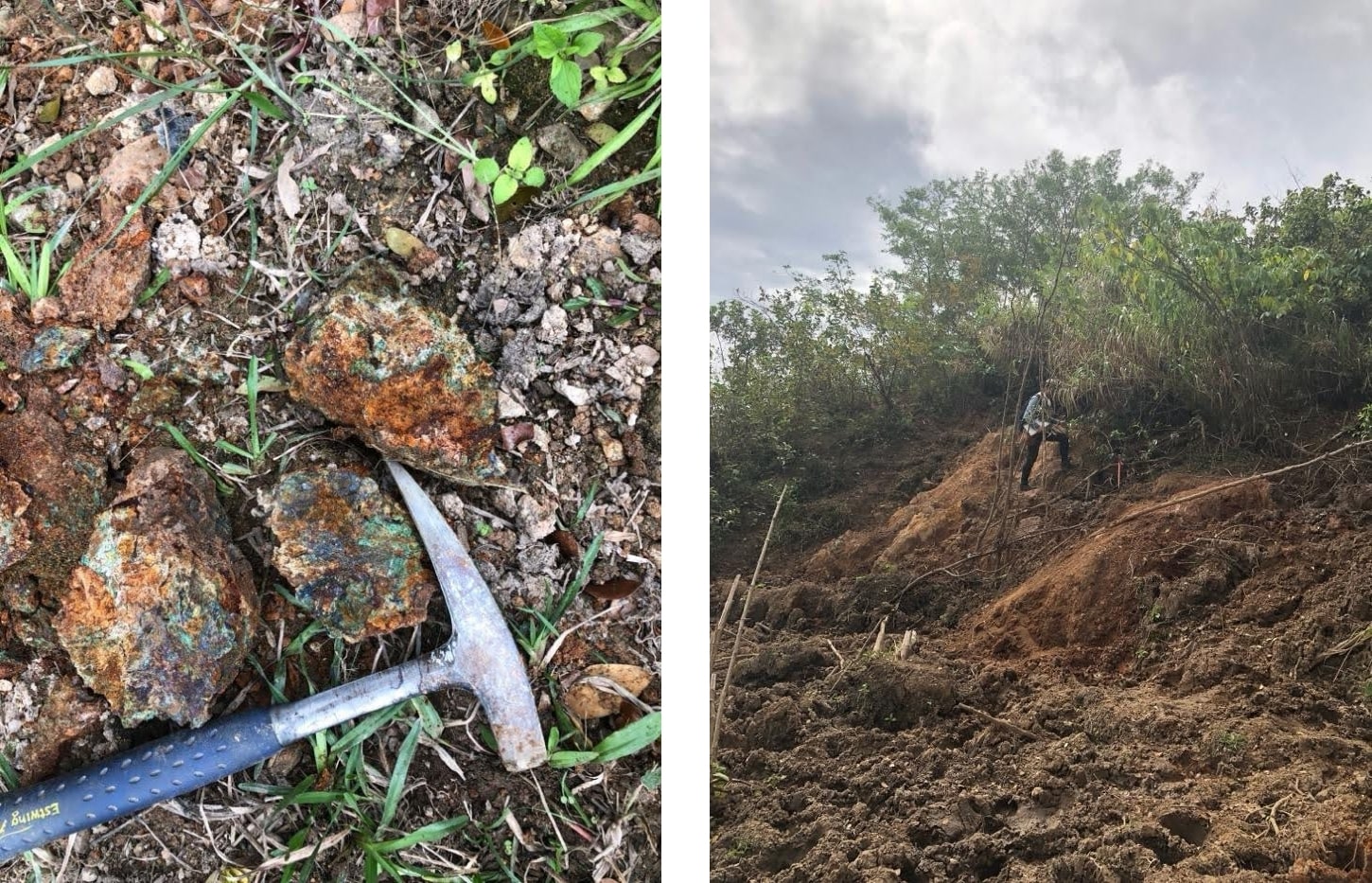
Nakoro is located in hilly grassland with distinct brecciated and massive zinc and copper mineralization.

Geologically, Viti Levu has been exposed to a complexity of crustal plate rotations and has been dominated by island arc development followed by rifting, like that of neighboring Pacific Rim countries. Magmatism, precious, and base metal emplacement occurred episodically throughout the evolution of the Fijian platform. The oldest known mineral occurrences are hosted within low-K tholeiitic volcanics of the Wainimala Group, host to the Nakoro and Korokayiu VMS prospects. The Wainimala Group are of Late Oligicene to Middle Miocene Age (28-16 million years) consisting mainly of basaltic volcanic and, to a lesser extent, sedimentary rocks which were subjected to extensive faulting and folding.

Figure 1: Map of Viti Levu, Fiji. Nakoro is hosted in the Wainimala Group. (Black dashed line is the trace of the Wainimala Oriclinal Flexure)
The Nakoro prospect area contains numerous limonitic gossans over a strike length of 700m (Figure 3). Beneath the gossans is intense silicification and phyllic, argillic alteration, with the silification being the more extensive. Mineralization occurs as massive sulphides, sulphide rich veinlets and within silicified rocks as sulphide disseminations (Figure 2). Common minerals include pyrite, sphalerite, barite, chalcopyrite, bornite and covellite with minor galena and tetrahedrite-tennanite.
Figure 2: Nakoro gossans with massive sulphides
Historic drilling intersected a massive sulphide zone to a depth of approximately 125 m and has shown the zone to strike northeast (similar strike to the gossans), with a shallow dip to the southeast (Figure 3). Mineralization is open in all directions.

Figure 3: Nakoro prospect geology
Exploration Potential
The Nakoro VMS prospect sits on an 8km prospective geologic horizon with high-grade historical drill intercepts of copper and zinc and favourable topography, weather conditions and a supportive local community. Recent mapping and sampling programs extended the known mineralized VMS system from 700m to 2.7km, while geophysics provided target definitions for further drilling. The targets highlighted at Nakoro warrant further exploration through modernized, higher resolution techniques and drilling of high-grade zones to expand the known extent of mineralization.


